Geopsy: Map Options
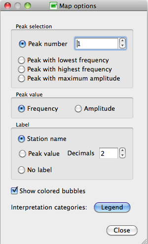
The display parameters may be changed with the pop-up window Map options, divided in four sections:
- Peak Selection
- Peak Value
- Label
- Colored bubbles and legend
Peak Selection
There are four possibilities to select the peak of which the value will be displayed:
- the peak number, according to the peak position along the curve, chosen in the box
- the peak with the lowest frequency
- the peak with the highest frequency
- the peak with the highest amplitude, regardless of its frequency and position in the curve
When all curves present only one peak, and/or no peak, all four options lead to the same display, except a Peak number value greater than 1, in which case no information on the peak values (color nor label) are displayed.
Peak Value
Label
Indicates how the receiver locations are labeled:
- Station name: the name used in geopsy for the receiver.
- Peak value: the frequency or amplitude of the peak that have been chosen in the Peak selection section, with the number of decimals set in the Decimals box.
- No label.
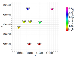
For example, when Frequency in the Peak value section is selected, the peak frequency values replace the receiver name next to the frequency color coded symbol.
Coloured bubbles and Interpretation categories
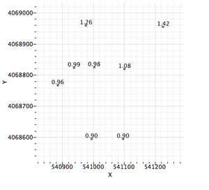
- If the Show colored bubbles box is not checked, only the symbols and the label at the receiver locations are shown.


